|
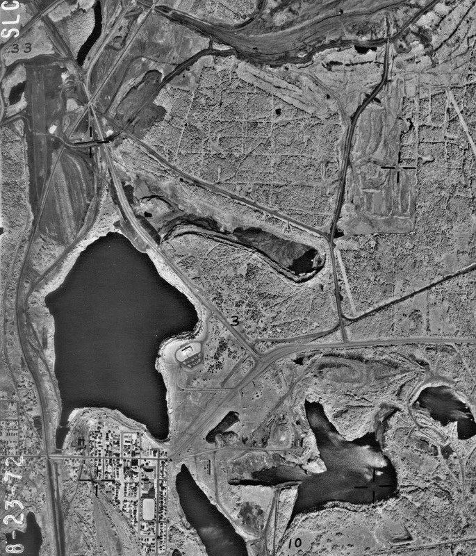
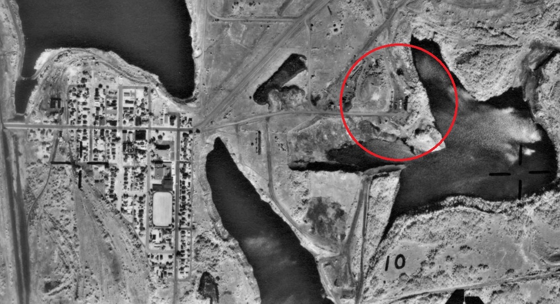
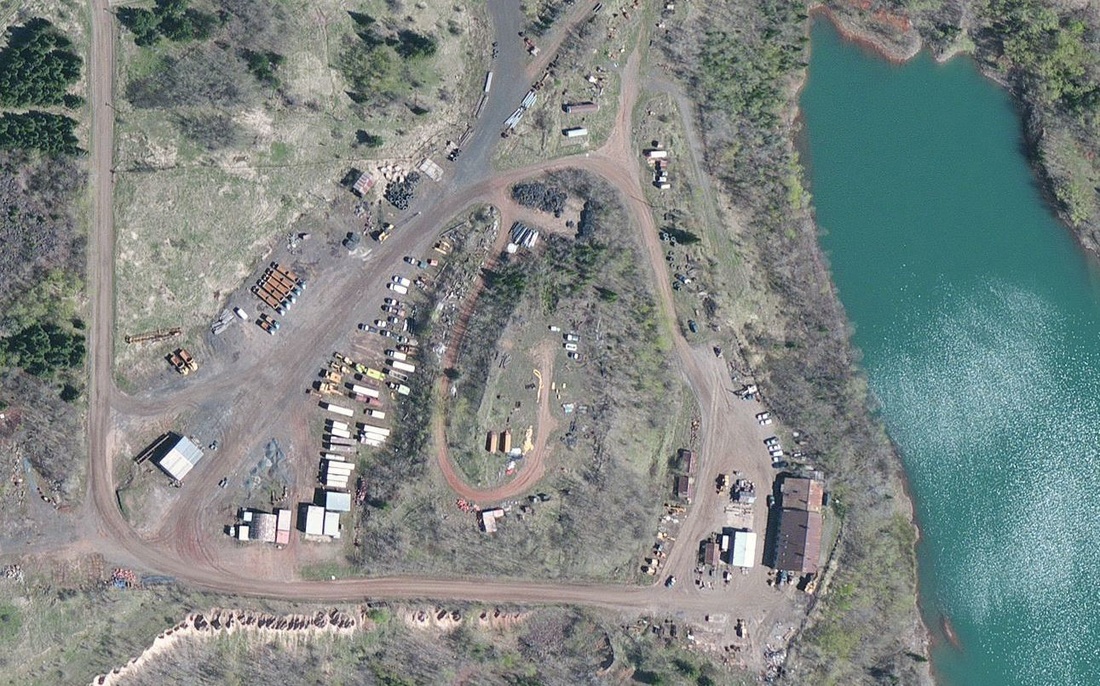
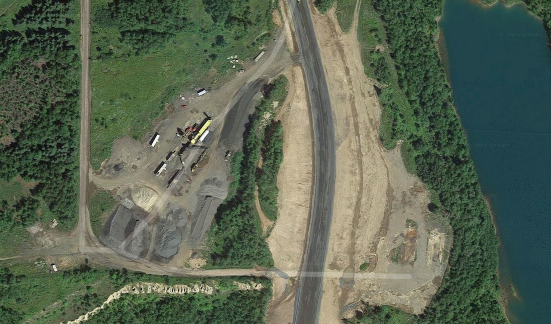
If you have been following this blog, you will know that part of my research has involved tracking the facilities that processed low-grade iron ores and produced tailings in the Mesabi Range. These facilities were called beneficiation plants (ben-eh-fiss-ee-ay-tion plants), iron ore concentrators, or ghost plants if you are referring to this blog. Historically, 88 beneficiation plants stretched across the Mesabi Range. Today 13 of these plants remain standing - but 2 weeks ago, I would have told you that there were 14. Time flies when you are having fun. Coming up with these figures was a convoluted process. Since processing plants are not tracked by any government agency, and because most mining heritage sites tend to focus their attention more on the mines than the processing plants, pinpointing were these facilities once existed required quite a bit of archival legwork. Identifying the locations of these 88 beneficiation plants required examining historical maps, historical aerial imagery, paging through old trade journals, and using web-based services like MNTOPO to analyze the current landscape. The images above and below are examples of the many high-quality aerial images provided by MNTOPO. Since so many of these plants have been removed from the landscape, these historical snapshots were an indispensable resource for identifying the historical locations of these beneficiation plants. When I started developing this inventory, I wanted to see how many beneficiation plants were still standing, in order to make some preliminary judgements regarding potential interpretive value at these sites. The Wacootah Concentrator, which was located in Mountain Iron, MN and operated from 1950-1964, nearly made the 'still-standing' cut. 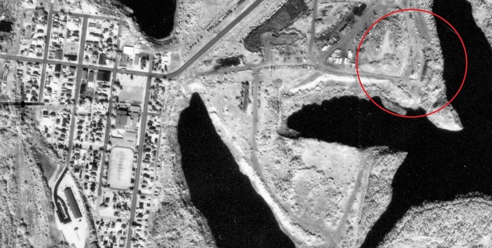 Zoomed in overview of the Wacootah Concentrator in 1989 - note the additional structures not seen in 1972 (MNTOPO) Zoomed in overview of the Wacootah Concentrator in 1989 - note the additional structures not seen in 1972 (MNTOPO) A nice feature within the GIS software ArcMap, is the ability to add baseman imagery to whatever map you are working on. This allows you to generate 'on the fly' overviews of whatever spatial extent you are examining. I used these basemaps as a primary tool used in determining what beneficiation plants were still standing, and which were removed from the landscape. The structural complex seen in the above image is the Wacootah Concentrator from around 2014-15. This was the first modern imagery I saw of the Wacootah, and at first glance I scored this plant as 'still standing'. But as I zoomed into the facility a little closer, and at a new scale or resolution, the landscape quickly changed, and Voila, the Wacootah was no more. The zoomed-in image is from 2016, and captures the apparent scrapping of the plant from just the past year. Aerial imagery used in ArcMap applications and Google Earth uses a collection of images taken at different times - times that might change as the scale or resolution of the area being examined is zoomed-in on, or zoomed-out of. I've since been trying to find out exactly what happened to the Wacootah - but haven't had any luck. If you know, please comment below. So the moral of the story is: always double check your data, and appreciate your industrial heritage while it is still standing - because it might be gone in the blink of an eye - or, in the case of the Wacootah Concentrator, the click of a mouse.
4 Comments
Todd Monroe
8/9/2016 11:56:00
That actually looks like mining shops. I looked at the 1955 and 1959 GNIOP maps and it appears that they loaded directly into railcars from a loading ramp. The maps just list the building in question as mining buildings. It does appear as the pit might have been rail operated at one time, but I don't my Directory of Mine handy to determine what was actually done. There was a loading pocket on the northeast side of the pit that loaded directly into railcars. My best guess would be that these would be delivered to a wash for hire plant, like Coons-Pacific, for washing.
Reply
John B.
8/12/2016 14:11:02
Thanks Todd, and good eye. I'm re-examining many old maps right now trying to see if I can find evidence of the plant elsewhere. It might have been located south of the mine itself, closer to the Iroquois Mine.
Reply
Travis
8/20/2016 01:47:23
I can't say for sure what those buildings were, but as for what happened to them: they were razed to accommodate the new Minntac access road whose path runs through that picture. The former County Highway 102 was closed to prepare for southward expansion of the east pit.
Reply
John B.
8/22/2016 09:33:40
Hi Travis - thanks for the info! One of the biggest challenges of this project is identifying when and why these facilities were finally scrapped.
Reply
Leave a Reply. |
AuthorJohn Baeten is a Postdoctoral Fellow in Spatial Analysis of Environmental Change in the Department of Geography at Indiana University. He holds a PhD in Industrial Heritage and Archaeology from Michigan Technological University. His research aims to connect historical process to current environmental challenges, and to contextualize the environmental legacies of industrialization as meaningful cultural heritage. Archives
September 2018
|
 RSS Feed
