|
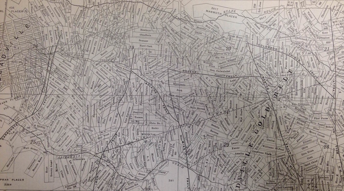
I scanned this map because I think it is a great representation of an historical mining landscape. Both extremely convoluted and strikingly organized, with geologic and political boundaries meshing together in a geometric cacophony. Maps like these illuminate how interpreting the historical mining landscape can be especially challenging, due to the scale of extraction and the overlapping of ownership from one claim to the next. This historical complexity often obfuscates some of the envirotechnical activity that created the landscapes we see today, as well as makes tracking the environmental legacies within these landscapes troublesome.
1 Comment
I'm in the process of testing a hypothesis on the heritage process, visibility, and remembering in the Mesabi Range. I believe that there is a much higher percentage of historic mines that are still visible on the landscape compared to the ghost plants, and this is one of the reasons why the mining pits have tended to dominate the contemporary heritage discourse of the Lake Superior Iron District, even though their environmental footprint may have been less impactful than the invisible ghost plants.
To test this assumption, I've been surveying aerial imagery of the Mesabi Range to see how many former mines and their waste piles are visible on the landscape, as well as their associated ghost plants. In doing so, I've become amazed by how many water bodies are dotted across the post-industrial landscape - granted this is the land of 10,000 lakes - and thought this would be a good time to post a rhetorical question that I continue to dwell on - How do you interpret a mine that has become a lake?
A somewhat cheesy video from the 1950s - but an interesting one nonetheless - as it depicts the push to make taconite a household name and a national mainstay. Some nice footage of the pelletizing process to boot:
This is a quick preliminary video showing the shipment of iron ore from Lake Superior mines from 1897-1981. It has a handful of glitches, but serves as an interesting visualization of iron ore mining and the patterns that emerge following the Great Depression, World War II and the onset of the taconite boom. Enjoy. I stumbled upon this video ages ago while researching placer mining in the Northwest. It's a fascinating - terrifying video - knowing what we know now about asbestos. |
AuthorJohn Baeten is a Postdoctoral Fellow in Spatial Analysis of Environmental Change in the Department of Geography at Indiana University. He holds a PhD in Industrial Heritage and Archaeology from Michigan Technological University. His research aims to connect historical process to current environmental challenges, and to contextualize the environmental legacies of industrialization as meaningful cultural heritage. Archives
September 2018
|

 RSS Feed
